|
||||||||||||||||||||||||||||||||||||||
|
Home
> TOPOSED - coupling
TOPOSED - coupling
TOPOSED (Simoes et al., 2010) is a large-scale continental erosion-transport-deposition model that we have developed in an attempt to invert the sedimentary record compiled during in the TopoAfrica project to extract meaningful information about the large-scale, long-term topographic evolution of the continent.
TOPOSED is based on a simple erosion equation that assumes that erosion rate is proportional to the large-scale (100 km) relief and precipitation rate. This approach is based on the strong correlation that exists (today) between small scale (<1 km) relief and large scale topographic gradient. We have also used observed relationships between river/cathcment sedimentary yield and precipitation from the Andes (Aalto et al, 2006), as well as the results of scaled laboratory experiments (Babault et al., 2005) to derive a plausible relationship between rainfall and mean erosion rate and calibrate it. A first-order calibration has been obtained by comparing present-day sedimentary yields measured in many large river systems to our model predictions applied to present-day continental surface topography. TOPOSED is now being applied to topographic scenarios derived from a complex mantle convection model run backwards in time to predict the dynamic topography generated by mantle flow beneath Africa over the past 30 Myrs (Moucha and Forte, 2011). The model predictions are currently compared to the sedimentary flux estimates and will soon be included in a formal inversion procedure to obtain the best model parameters, such as those used in the relationships between relief, climate and erosion rate, as well as those controlling the amplitude and the timing of the predicted dynamic topography. In this way, we hope to provide constraints on the topographic evolution of the African continent but also on the viscosity and structure of the mantle and its evolution through time. 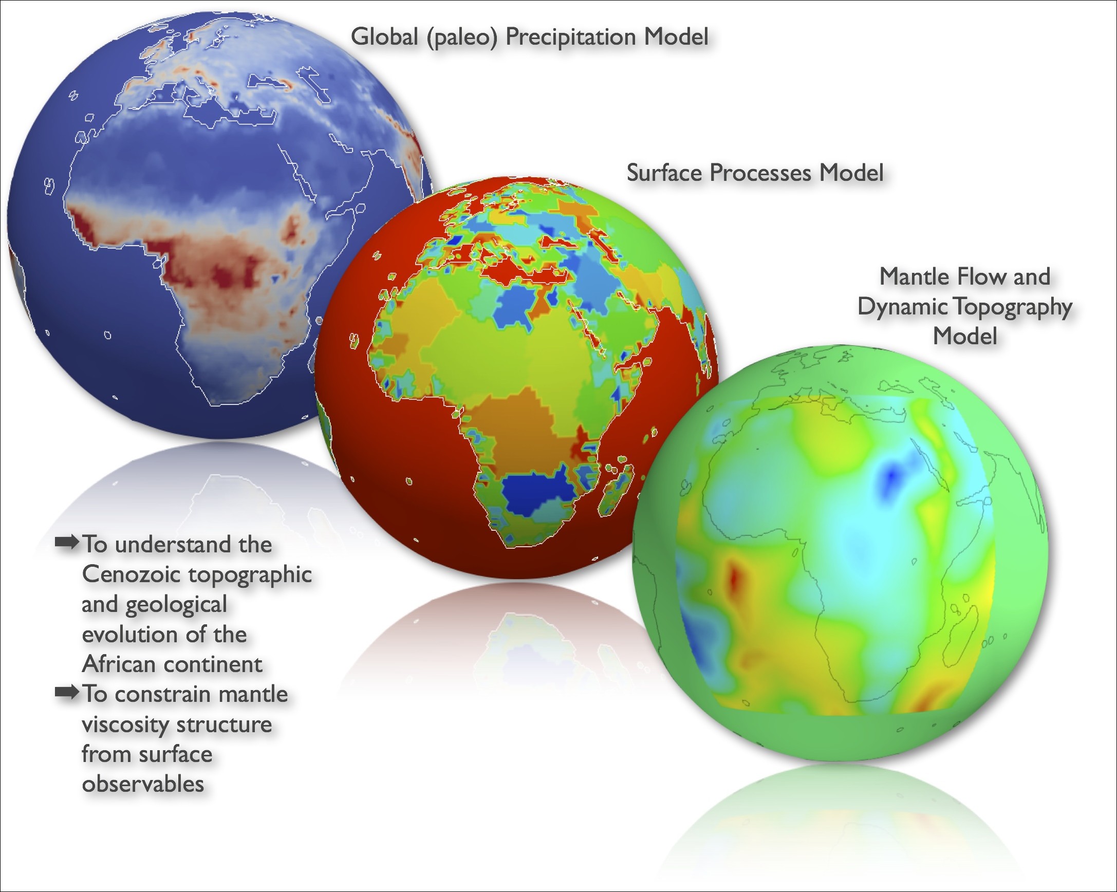
The three main components of the coupled mode: (1) a global circulation model run in paleo-geographic conditions (continent geometry, pCO2, etc.) at selected time intervals over the past 30 Ma; (2) TOPOSED, a new surface processes model developed in the context of the TopoAfrica project and (c) a mantle convection model run backward in time to predict dynamic topography beneath the African continent over the same time intervals.
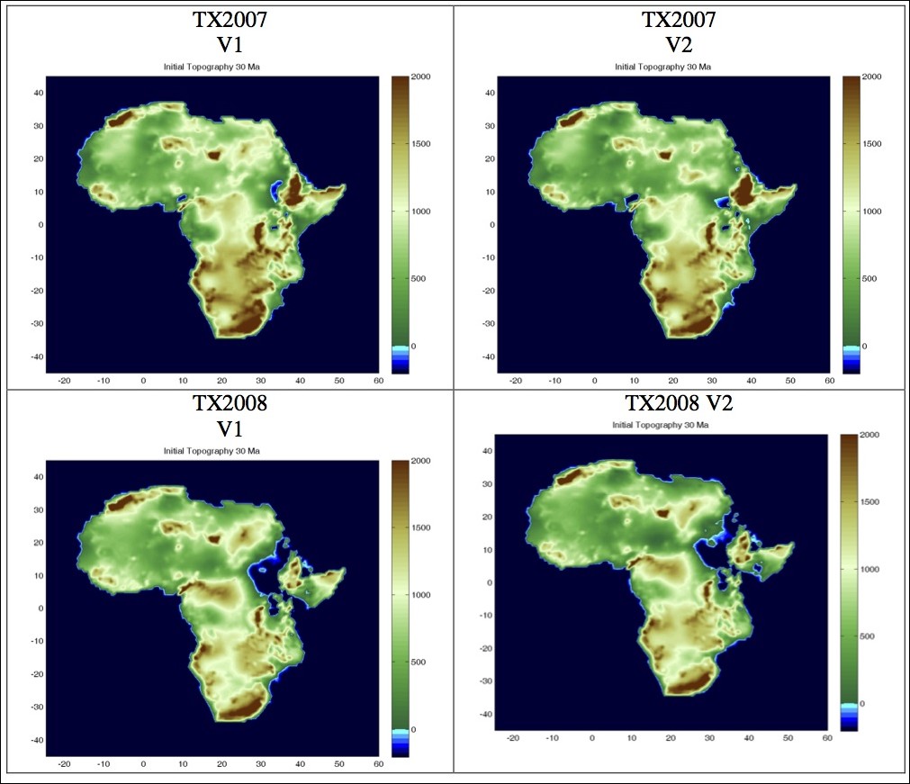
Preliminary results: four retro-dicted topographies at 30 Ma, based on different assumptions in the mantle flow model (viscosity, density variations in the mantle).
Interestingly, the preliminary results show that the model response is very sensitive to the climate/precipitations used to drive the erosion and the transport of sediment. Work is under way to use GCM-derived paleoprecipitation patterns in the inversion and/or those derived from geological observations.
|
||||||||||||||||||||||||||||||||||||||