Most existing paleogeographic maps are based on the inference of coastlines and the extent of the marine environment. Few maps are deal with the continental systems due to the difficulty of dating and interpreting continental deposits.
We focused on:
The location of the continent-ocean boundary (and the location of an intermediate crust, if it exists) as well as the age of the first oceanic crust (with uncertainties),
The location of the marine shoreline (wave vs. tide dominated) and the extent of deltas (fluvial, wave and tide-dominated),
The type of shallow marine system (ramp vs. slope),
The location and type of carbonate platforms,v
The "bayline" or upstream limit of the coastal plain,
The geometry, depth and character (perennial versus ephemeral) of lakes,
The type of depositional fluvial systems: anastomosed, sinuous, slightly sinuous or braided, well as the presence of alluvial fans,
The nature of alluvial plains: aeolian dunes, different types of weathering profiles, marshes,
The patterns of paleocurrents within the fluvial deposits,
The onland paleogeomorphic and paleoweathering patterns where and when available.
Furthermore, for each time interval, the limits of the main watersheds and the boundary between their depositional and erosional parts have been identified, based on the mapping of fluvial paleocurrents, alluvial facies and the petrographic nature of the source area, lava flow directions, some structural information and preserved erosional landforms.
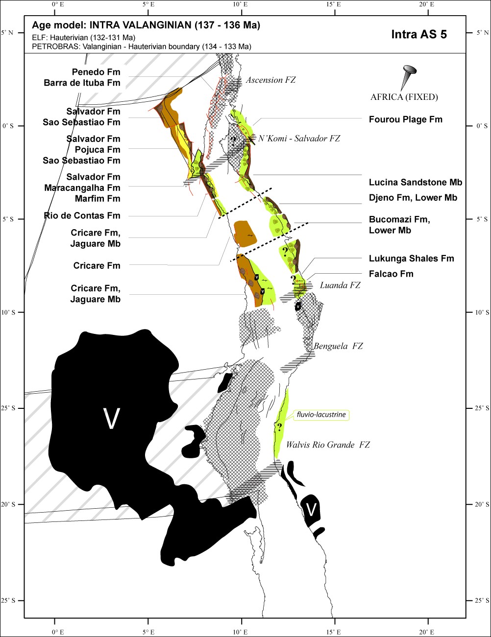
Example of detailed palaeogeographic maps: the intra Valanginian (137-136 Ma) of the central segment of the South Atlantic Ocean (Chaboureau et al., Tectonophysics, on line september 2012).
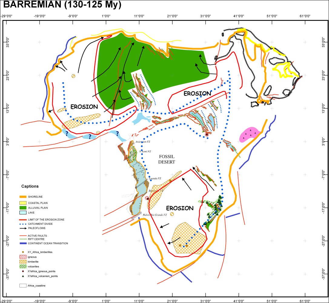
Example of new style palaeogeographic maps at the scale of continent: Farica during the Barremian.
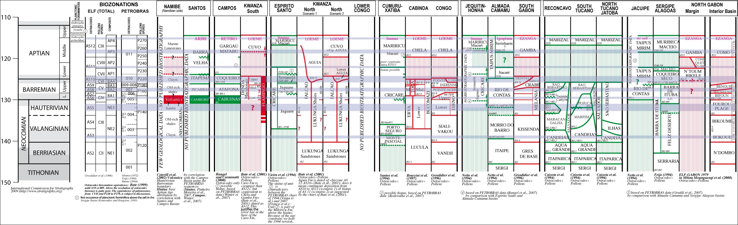
Example of detailed chronostratigraphic charts required for palaeogeographic maps: the biostratigraphic (ostracodes and pollen) and lithostratigraphic chart of the Cretaceous ante-Albian deposits of the central segment of the South Atlantic Ocean (Chaboureau et al., Tectonophysics, on line september 2012).
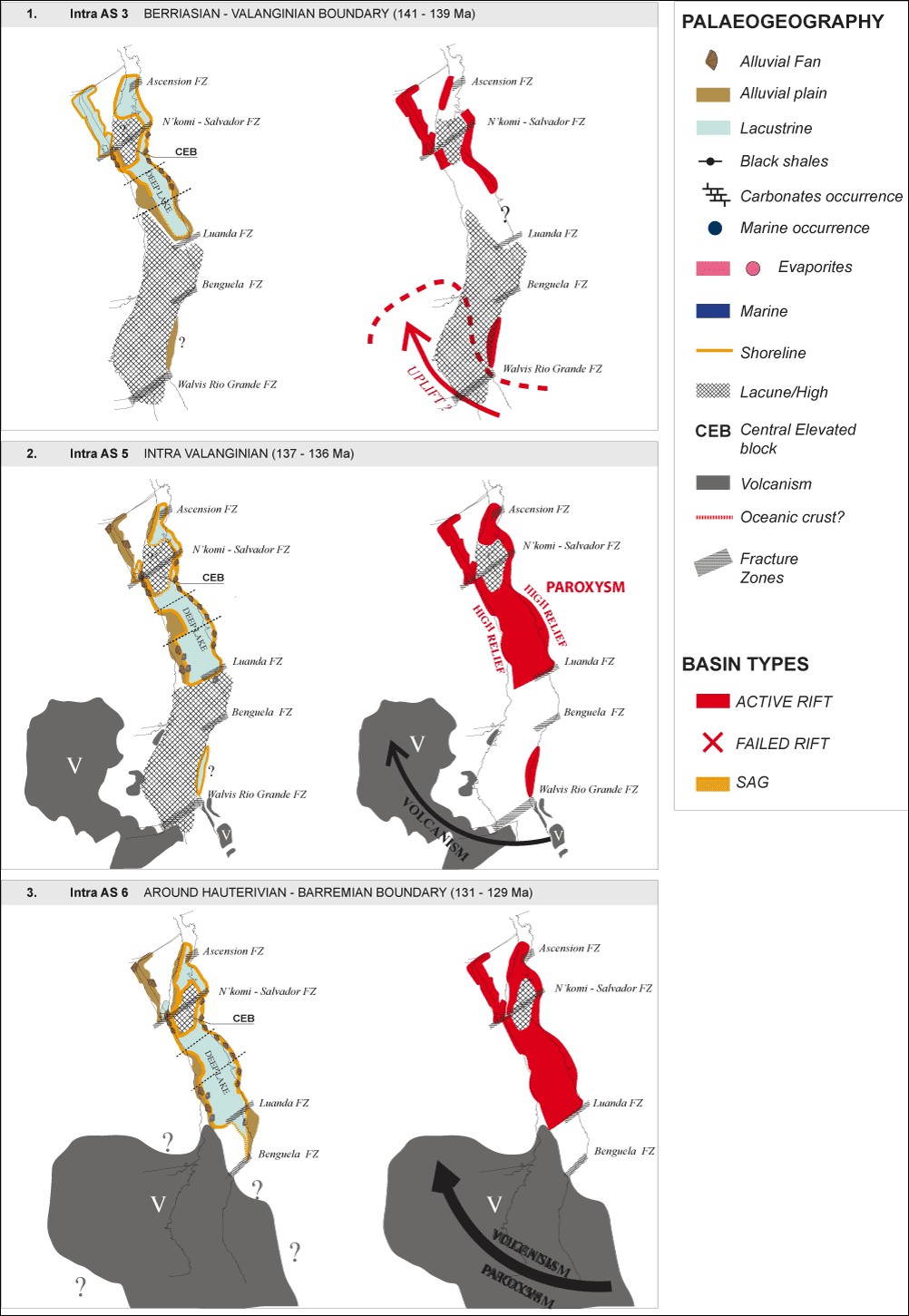
Example of summary palaeogeographic and geodynamic maps for the early stage of the central segment of the South Atlantic Ocean opening (Chaboureau et al., Tectonophysics, on line september 2012).